Exploring Oaxaca’s Peri-Urban Landscape

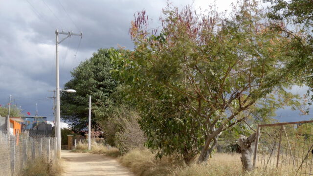
Walking along the dusty road in San Felipe del Agua, we heard the faint sound of cowbells clanking somewhere around the next bend. My spouse Ashley, who had done fieldwork in rural Kenya where cattle are commonly driven along roads, suggested that we wait along the side of the road to let the cows pass by. So we stood there for several minutes on what was once a sidewalk, but had long ago crumbled into rubble. The iron-rich earthen slope behind us was thickly grown with sedges, feather grass, elephant ear plants, prickly pear cacti, bracken, and the gnarled roots of stunted eucalyptus trees. Soon a man came slowly up the road driving half a dozen cattle, occasionally tapping one or another gently on the backside to prompt them forward. We exchanged friendly greetings, waited for the ensemble to pass by, and then proceeded along our way.
While this might seem a quintessential rural scene, we were only seven kilometers north of Oaxaca City’s historic center, walking through what many scholars call the “peri-urban” landscape. While my own work in Mexico is largely focused on urban spatial form in Mexico City, I am interested in the wide variety of landscapes that have emerged within and around Mexican cities over the last fifty years. To this end, I traveled to Oaxaca in 2018 and 2019 in order to study its history, architecture, and urban morphology. During these visits, I made close studies of places characterized by the entanglement of rural and urban forms and networks, such as the Central de Abastos (main wholesale market) and the Panteón General (main cemetery). In this essay, I use photography as a way to think about the natural and human ecologies that take shape in the betwixt and between spaces of Oaxaca’s peri-urban landscape.
History and Structure of Oaxaca’s Peri-urban Landscape
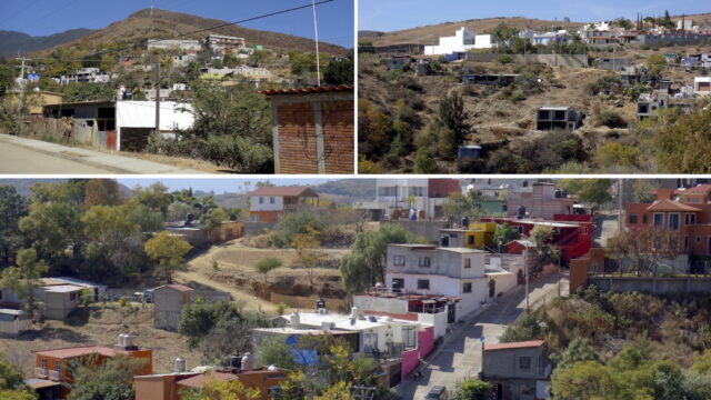
Established by Spanish conquerors in 1521 on Zapotec and Mixtec lands, Oaxaca town spread out slowly from the cathedral and plaza at its historic core (now a UNESCO World Heritage Site). Until the nineteenth century, the edge of town was defined by a stark division as the city grew through the extension of the Spanish grid. After the revolution ended in 1917, however, an ever-increasing flow of new arrivals from rural areas led to the establishment of informal squatter settlements encircling the city, breaking apart the old grid into new forms, fanning out and spreading up the slopes of surrounding mountains.

As these settlements annealed into more or less regular barrios of the city in the 1970s and 1980s, new suburban developments opened up at even greater distances from the town center. Today Oaxaca (sometimes called Oaxaca City or Oaxaca de Juárez) is a conurbation—an area of densely interconnected urban settlements—of 300,000 people, surrounded by large ring roads, strip malls, subdivisions, big box chains, gas stations, and all the accouterments of a globalizing city.
Once you pass through this outer zone, however, you do not simply fall out into rural Oaxaca—the Oaxaca of communal lands (ejidos), Indigenous villages, smallholder farms, and collective labor obligations (tequio). Rather, you arrive at San Felipe del Agua and similar communities, situated between the expanding metropolis and the distant lands of rural Oaxaqueños. Where the eighteenth and nineteenth century city might have stood in relatively stark distinction with its agro-forested surroundings, over the course of the twentieth century a variety of communities grew up around the city, either as new migrant settlements or as villages swept up in the process of metropolitan expansion.

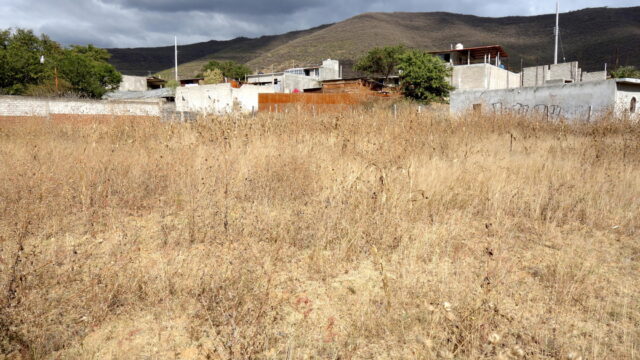
The ecology of these areas is best characterized through patches and transitions, where pine-oak and montane forests occupy the higher elevations, giving way to semi-arid meadows and scrub of the lower slopes and flatlands. Many of the forests have fallen to extraction over time, except in nearby conservation zones, where Indigenous Oaxaqueños continue to exercise usufruct rights of gathering wood and hunting. Most of the trees found in these edge zones are not primeval holdovers, but have been planted by farmers and pastoralists, either as a source of fruit and wood or for shade, soil retention, and windbreak along herbaceous borders. These varied natural and human edge ecologies braid together to form unique cultural landscapes.
It is in such places that people work out social, economic, and ecological relations suitable for life in between, for a habitat that is neither urban nor rural and yet both in varied measure. It is a kind of zone of assemblage, where residents research and develop modes of living by drawing together the threads of urbanity and rurality, suburban proximities and natural systems and processes.

Edge Geographies
The Greek root “peri-” denotes something near or around, as in “perimeter.” Peri-urban is one of the key terms in the lexicon of urban ecology. Scholars use it to describe particular landscapes, environments, or geographies either on the proximate margins of, or entangled in relations with, large cities and urbanized regions. However, the term is problematic because it is both ambiguous and teleological: it denotes the spatial condition of a place only in terms of its relation to something else—in this case to an urban agglomeration. Such places could just as well be called “peri-rural,” for their connections to agricultural, pastoral, and less inhabited hinterlands. Of course, this term is just as problematic as “peri-urban.”
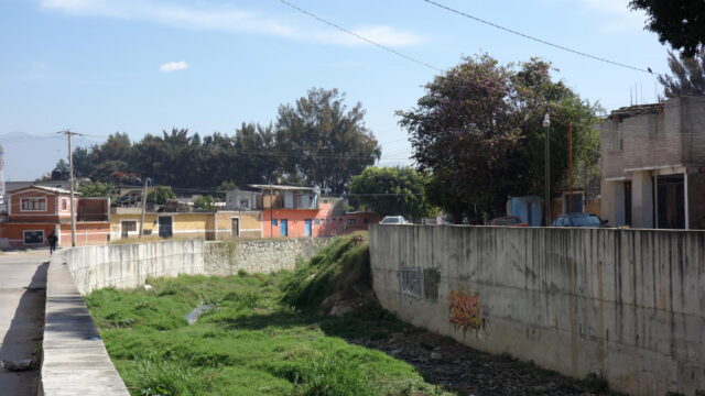
In many respects, the road we walked in San Felipe del Agua was neither urban nor rural, but a mix of both, and something altogether different, hard to define. Here, landscape, habitat, and ecology take on forms that overlap with but also diverge from those of the city. Even the dust-coated plants that surrounded us on the side of the road comprised a mix of native and imported, cultivated and volunteer species forming a ruderal, roadside ecology. The remnant sidewalk on which we stood reflects a valiant effort at infrastructure building on an urban model, but its crumbled state announces the limits of such efforts. Clearly, this setting is neither city nor country, nor is it simply one of the many suburban developments surrounding Oaxaca, made by the outward push of the urban macroform into regional space.
It is in such places that people work out social, economic, and ecological relations suitable for life in between.
While it is tempting to describe places like San Felipe del Agua as exhibiting simultaneous modes of urbanity and rurality, this implies the existence of a kind of smooth gradient along which the urban flows into the rural. Walking through such places, however, reveals a mosaic of landscape forms characterized by juxtapositions, abrupt distinctions, and blended forms of architecture, settlement, and ecology. The entanglements of urban, rural, suburban, and natural forms create distinct kinds of places, however temporary, fragile, and changing. This also holds for locations at varied distances from the center, whether in a proximate settlement like San Felipe del Agua or a more distant village swept up into social and economic relations with the city. While the term peri-urban suggests geographic adjacency or proximity, it is better understood as an index of spatial relations between nodes and networks, where locations become entangled at a distance based on the frequency and salience of their (often unequal) material, social, and metabolic exchanges.
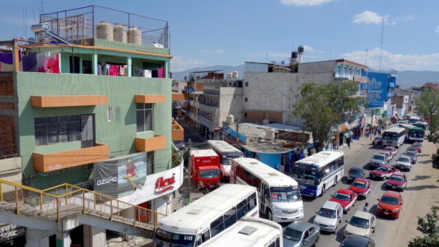
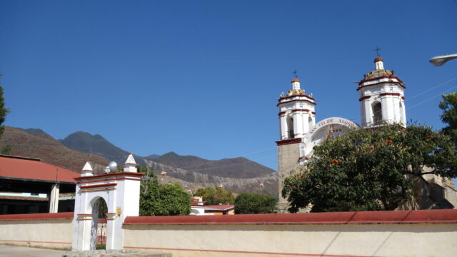
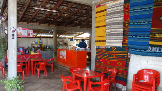
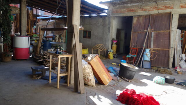
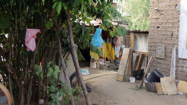
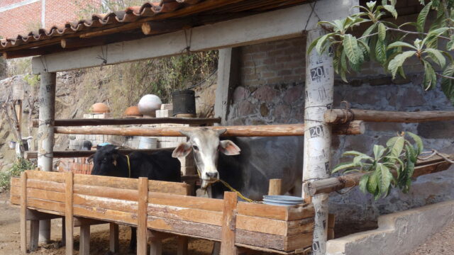
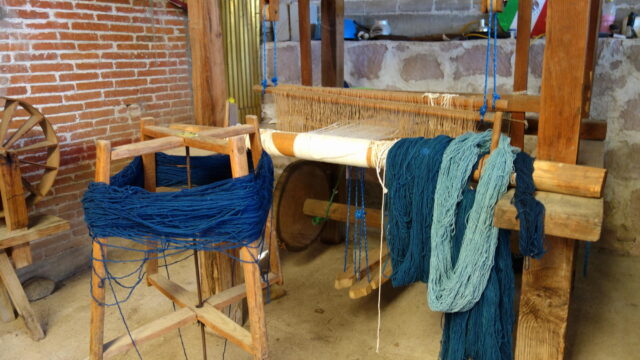
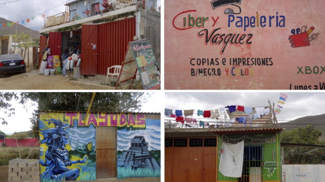
In the photographs that follow, I explore this peri-urban mosaic in several locations around metropolitan Oaxaca. Most of the locations we encountered at random by taking regional buses as far as they would travel, heading to the north, southwest, and east of the city center. In each location, I took photographs of landscape forms and elements that reflect the entanglements of human and natural conditions. While I draw on traditions of documentary photography in my work, I do not consider images to be straightforward instruments of truth telling or windows into some unmediated reality. Rather, I use photography to explore the contingent, multifaceted, and always-unfinished relations among people and the landscapes that they create and inhabit.
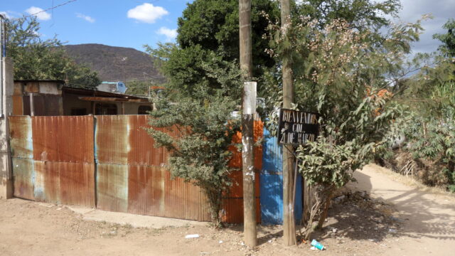
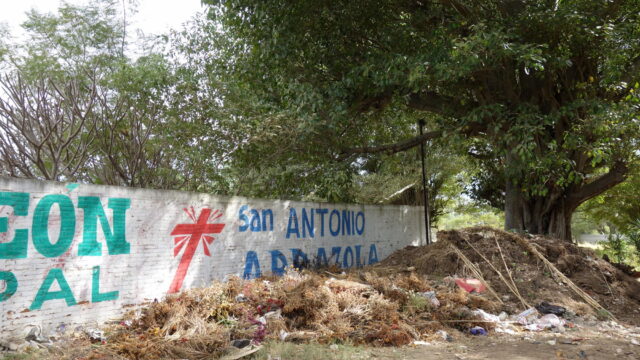
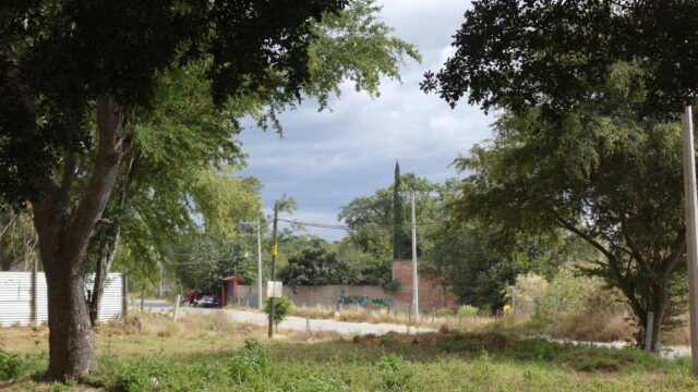
The Peri-urban Landscape, Betwixt and Between
The mosaic landscapes often called “peri-urban” gives rise to their own kinds of communities and forms. Here people devise relationships to nature and ecology that differ in important ways from both town dwellers and rural agriculturalists and pastoralists. A family might keep a small number of cattle, but also work in town driving trucks or cleaning houses or selling goods in the wholesale markets—jobs too distant for rurales to access in any regular way. They might have a small plot of land where they grow corn in back of their shop on a busy road. Restaurants are more like cantinas or camp mess halls, lovely in their own way, open to the country air. Churches sit comfortably in their own grounds, uncrowded by the block densities found in Oaxaca town. Households are sites both of production and social reproduction all in one; there is not land enough to sprawl out into big yards, but there is enough to store materials and machinery and carry out enterprises connected to urban proximity, such as textiles, food preparation, cabinetry, and so on.
The road we walked in San Felipe del Agua was neither urban nor rural, but a mix of both, and something altogether different, hard to define.
These places have their own register, their own rhythm, their own sensorium that are not adequately captured by terms like ‘peri-urban.’ Of course, they are frequently drawn into exploitative relations with cities, but identifying the socio-spatial liniments of these relations can be challenging, except in obvious situations such as pollution, dumping, extraction, and other highly visible metabolic externalities. More often, the forces that connect these landscapes to rural and urban processes are occulted and obscured, difficult to discern on the ground. Omnibus terms like urban, rural, and peri-urban are inadequate to capture the nuances of these relationships, heavily freighted as they are with meanings forged in Eurocentric planning and development visions of the world.

Walking through San Felipe del Agua, you might hear birdsong, a braying donkey, a rooster crowing, or the gentle lolling of cows. It is quiet enough to hear the wind blowing through trees and bushes. At same time you might hear the staccato rap of hammers and the whine of circular saws from a nearby residential subdivision under construction, or the grind of gearboxes from school buses and water trucks and parabuses. The pop of gravel under tires alerts you to an oncoming vehicle. The faint cry of a siren from a main road is near enough to be heard. Electric wires whine in the wind overhead, and the sweet smell of cow dung hangs in the air. This is peri-urban Oaxaca, betwixt and between, and very much its own place.
Featured image: Waiting for cattle to pass in San Felipe del Agua. Photo by Author, 2019.
Joseph Heathcott is Chair of Urban and Environmental Studies at The New School in New York, where he teaches in Parsons School of Design and the Milano School of Policy, Management, and Environment. Website. Instagram. Contact.
You must be logged in to post a comment.